
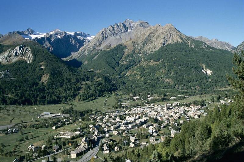
GR®54 - Tour de l'Oisans et des Écrins depuis La Grave, par le GR®54C et les variantes alpines
Starting from a high place of mountaineering, the hiker takes place among the emblematic summits for an exceptional two-week stay in the Ecrins.
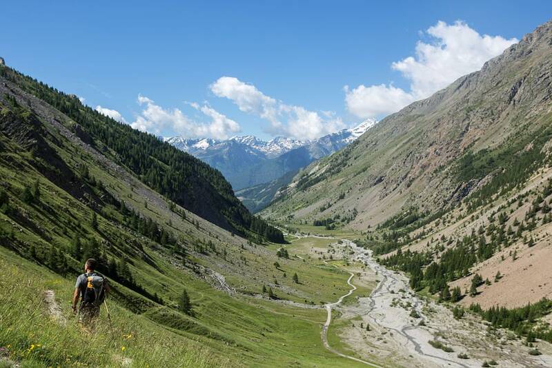
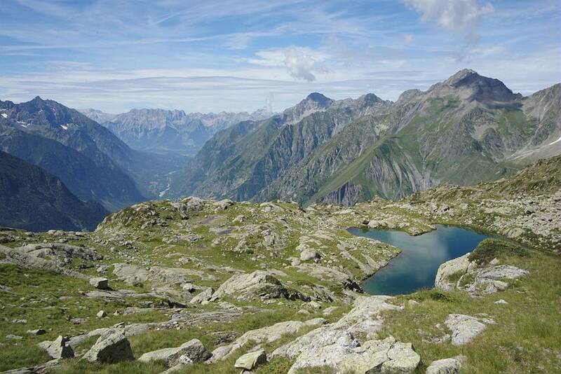
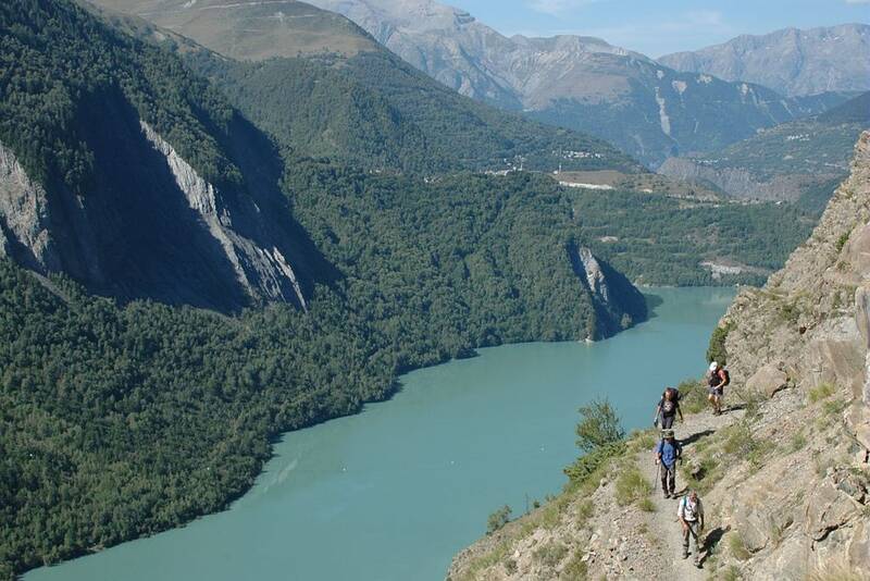
Departing from La Grave, the Tour de l'Oisans et des Écrins begins its grand tour, at the foot of the majestic summit of the Meije, along the Romanche to its source on the Villar d'Arène mountain pasture. Arriving at the Col d'Arsine, the view is breathtaking. The high mountain world invites you to visit the glacial lake of Arsine before beginning a long descent along the Petit Tabuc torrent to the Guisane valley and Monêtier-les-Bains. On to Vallouise via the Col de l'Eychauda and the peaceful chalets of Chambran. Eight kilometres of passable road along the torrent de l'Onde take you to the Jas Lacroix mountain pasture. Crossing the Col de l'Aup Martin, the highest point on the entire route, is always a highlight of the adventure, and the descent to the Pré de la Chaumette is just as challenging. To reach Lac de Vallonpierre and the Valgaudemar, there are no fewer than three passes carved out of the schist that need to be negotiated with care. Along the Séveraisse, the path leads to La Chapelle en Valgaudemar, where you leave the main path to gain height on a variation of the GR®54 on the heights of the valley. From the refuge de l'Olan, the view of the Valgaudemar peaks and their glaciers is breathtaking. You join the route at the Souffles refuge and then the impressive Col de la Vaurze. Just as impressive is the descent into the wild Valjouffrey. The green col de Côte Belle is in stark contrast to the schist landscapes you encountered earlier. Valsenestre, in the Béranger valley, is a welcome stop-off before setting off again for the final meanders. Make way for the vertical Col de la Muzelle, the gateway to the Vénéon. A long descent to Vénosc forms the second variant of the GR®, where the route passes the famous resort of Les Deux-Alpes on both sides (Vénosc and Mont-de-Lans) and reaches the pretty village of Mizoen. The rest of the route climbs up the mountainside, skirting the large Lac du Chambon below, to reach the refuges at the foot of the Emparis plateau. Above, the Col de Souchet offers a five-star view of the Meije. Nearly 1,000 metres of ascent and descent will take you back to La Grave to complete this exceptional itinerary.
Overtures :

Mizoën
Lieu de départ : La Grave.Lieu d'arrivée : La Grave.Depuis Grenoble : 80 Km par la RD1091 direction Les stations de l'Oisans / La Grave / BriançonDepuis Gap :120 Km par la RN94 direction Briançon puis RD1091 en direction de Grenoble par le Col du LautaretParking conseillé : Parking à proximité des téléphériques .BUS:Ligne LER 35 au départ de Grenoble Gare SNCF / Routière - La Grave-Villar d'Arène-Briançon (Aller-Retour) / RESERVATION OBLIGATOIRE 24h à l'avance http://info-ler.fr/118-Boutique-en-ligne-LER-35.htmlLigne 3030 Transisère au depart du Barrage du Chambon ( situé à 20mn en voiture de La Grave-Villar d'Arène ) / Bourg d'Oisans puis Grenoble (Aller-Retour) http://www.transisere.fr/TRAIN:Gare SNCF de Grenoble (Isère) : liaisons régulières depuis la France entièreGare SNCF de Briançon (Hautes-Alpes) : liaisons régulières depuis Gap et Marseille. Train de nuit depuis Paris http://www.voyages-sncf.com/ ou 08 36 35 35 35.AVION:Aéroport International de Lyon St Exupéry : 166Km http://www.lyonaeroports.com Navettes jusqu'à Grenoble http://www.faurevercors-aeroport.fr/ ou 08 25 82 55 36Navettes jusqu'à La Grave, Les Samedis & Dimanches https://www.linkbus-alps.com/lignes/grenoble-aeroport/Aéroport Grenoble-St Geoirs : 125Km http://www.grenoble-airport.com/Navettes jusqu'à Grenoble http://www.actibus.com/aeroport/ ou 04 76 06 48 66Navettes jusqu'à La Grave, Les Samedis https://www.linkbus-alps.com/lignes/grenoble-aeroport/Aéroport International de Genève Cointrin : 223Km http://www.gva.ch/DesktopDefault.aspxNavettes jusqu'à Grenoble http://www.aerocar.fr/ ou 04 76 60 46 97